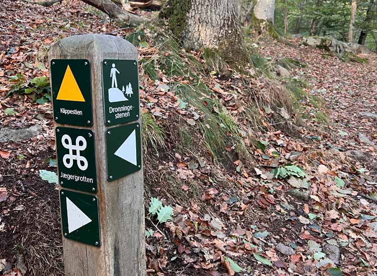
Hiking route: Almindingen Forest, The Bison Trail
Bornholm Hiking Guide
Bornholm is 588 square kilometres of pure paradise for hiking enthusiasts.
This page features hiking guru Gitte Holtze’s pick of favourite routes on Bornholm.
Bornholm Hiking Guide – your guide to a great hiking holiday on Bornholm
This page features hiking guru Gitte Holtze’s pick of favourite routes on Bornholm.
We also have plenty of good advice, useful tips and practical information to help you plan your hiking holiday on Bornholm.
Hiking is something everyone can do, and Bornholm has all the ingredients you need for unforgettable nature experiences.
Bornholm Hiking Guide – Tips for clothing and equipment
Bornholm Hiking Guide – Respect the surrounding nature
Hiking trails and routes on Bornholm
Most of the hikes in the guide are signposted, either with signs, such as on Kyststien and Højlyngsstien (with a sign of a white man on an orange background) or in most cases with different coloured dots on trees, etc.
Each route description will tell you how it is signposted.
The surface on Bornholm is a mixture of paved roads, trails, footpaths (on grass), forest paths, beaches, or – as is so typical for northern Bornholm – rocks.
Bornholm’s hiking routes – length and difficulty
Each hike in the guide is listed with a duration of time, which indicates how long the hike will take. Unless otherwise stated, the duration is for the whole trip and not just one way.
However, these times are just estimates, as everyone moves at a different pace. The guide is based on an adult, but not an experienced hiker, walking at a normal pace. If you are an experienced hiker, especially in hilly and uneven terrain, you will probably be able to walk faster than indicated here.
Small photo breaks are included in the duration, but longer meal breaks etc. are not, nor is carrying any required backpacks for Kyststien. The Højlyngsstien trail, however, is a different story, as most people who walk it spend the night in the open because it is the only option.
Difficulty is calculated in the same way: Based on an adult, not an experienced hiker, and is assessed by the route’s level of steepness, flat or uneven terrain, length, and any muddy surfaces.
We have also tried to provide an assessment of whether the hikes are suitable for children. However, as children are different, it is important that the adult makes their own assessment of the child’s physical shape and experience.
Hiking route: Almindingen Forest - Ekkodalen (The Echo Valley)
Hiking route: Almindingen Forest - The Cliff Path
Hiking route: Almindingen Forest, Ekkodalen (Echo Valley) to Rytterknægten
Hiking route: Almindingen Forest - Echo Valley to Hareløkkerne
Hiking route: Almindingen Forest, Kongens Borge
Hiking route: Borgedalsstien
Article Hiking route: Cirkelstien (The Circular Path)
Hiking route: Døndalen (Døn Valley)
Hiking route: Finnens Fodspor (Finnen's Footsteps)
Hiking trail: Round the Hammerknuden Rock
Hiking route: The Stonemason's Path (Stenhuggerstien)
Hiking route: Paradisbakkerne (Paradise Hills)- Yellow route
Hiking route: Paradisbakkerne (Paradise Hills) - Blue route
Hiking route: Paradisbakkerne (Paradise Hills) - Red route
Hiking route: Kobbeådalen Valley
Hiking route: Lines in the landscape
Hiking route: Svartingedalen
Hiking route: The Ringe Hills (Ringebakkerne), yellow route
Hiking route: The Ringe Hills (Ringebakkerne), Green route
Hiking route: The Ringe Hills (Ringebakkerne), white route
Hiking route: Højlyngsstien leg 1 - Sandvig to Ravnedalen
Hiking route: Højlyngsstien leg 2 - Ravnedalen to Rø Plantage
Hiking route: Højlyngsstien leg 3 - Rø Plantage to Rytterknægten in Almindingen
Hiking route: Højlyngsstien leg 4 - Rytterknægten to Ølene
Hiking route: Højlyngsstien leg 5 - From Ølene to Årsdale
Hiking route: The Listed Trail
Hiking route: The trail at Jons Kapel
Hiking route: Salomon's trail (Salomons sti)
Hiking route: Gyldenåstien
Hiking route: The Coastal Path leg 1 - Rønne to Hasle
Hiking route: The Coastal Path leg 2 - Hasle to Sandvig
Hiking route: The Coastal Path leg 3 - Sandvig to Gudhjem
Hiking route: The Coastal Path leg 4 - Gudhjem to Svaneke
Hiking route: The Coastal Path leg 5 - Svaneke to Snogebæk
Hiking route: The Coastal Path leg 6 - Snogebæk to Boderne
Hiking route: The Coastal Path leg 7 - Boderne to Rønne
App: Bornholm
Accommodation
Wild Camping on Bornholm
Hiking experiences on Bornholm
Bornholm is 588 square kilometres of paradise. A unique part of Denmark with its location far out in the Baltic Sea and with its distinctive rocky scenery.
But the island is not all rocks. There is also plenty of magnificent and unspoilt nature, making Bornholm a mecca for hikers and anyone else wanting to experience the island up close and at a slower pace on a short or long walk.
Find more information about hiking here
Good form, positive experiences and safe faring in nature