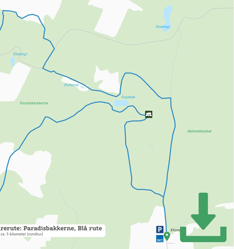
Map of the route
Below you can download a pdf with an A4 map of the route.
Route description
Set off at either of the car parks. If you set off by Gamleborg (the Old Castle), you’ll be one of the first to pass Gamleborg, the remains of the ring wall that was once a refuge in the Iron Age. Then the path bends sharply to the left and you walk through a forest and over a beautiful heather-covered plateau in the middle of the Paradisbakkerne.
Follow the blue squares towards Midterpilt and the view from the highest point of Paradisbakkerne, 113 metres above sea level. Note also the unique cairn, which is the height of an adult man, from which the place gets its name. In Bornholm, the word pilt is used to describe the cone-shaped cairns used to show the way – here in Paradisbakkerne through the old heathland, Højlyngen.
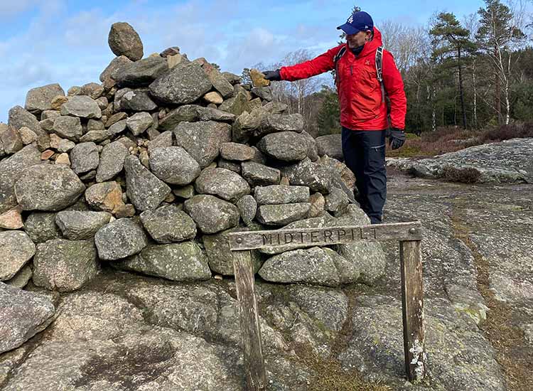
Midterpilt in Paradisbakkerne
From Midterpilt, the route leads through Grydedalen (Pot Valley) before joining the red route in a loop that takes you past the car park at Klintebygård (where there is a toilet and water), Fjeldstauen, Denmark’s first hostel and now a private cottage, Rokkestenen and the lovely Grydesø (Pot Lake).
The last part goes over open land and past Slingesten – one of the many boulders scattered like giant dice around the Bornholm landscape. In total, there are almost 200 of these tonne-heavy, metre-high stones. According to legend, Slingesten ended up here because a fierce troll from Christiansø missed his target, which was supposed to be Bodils Kirke (Bodil’s Church). In fact, it was the Ice Age that transported both this and the island’s other erratic boulders to their present positions.
After the Slingesten, the path winds steeply down and then up again. At the bottom of the canyon, nature has been given free rein, so be prepared to negotiate fallen logs and trees and possibly mud and damp.
Places on the route:
On this hike, you get a chance to visit the following places: