Article

Hiking route: Højlyngsstien leg 5 – From Ølene to Årsdale

67 kilometres and a multi-day trip across Bornholm through all the island’s wonderful natural scenery, from Hammerknuden and Rø Plantage to Almindingen Forest and the Paradisbakkerne (Paradise Hills).

Gitte Holtze

Hiker and outdoor freak as well as journalist, lecturer and author of "jeg lever" about Gitte's hike along the Pacific Crest Trail and "Gå langt", a guidebook to long hikes.

Trekandtell.dk

We have chosen to divide the route into five legs. This article describes leg five from Ølene to Årsdale.

Facts

Duration:
4-5 hours
Length:
13 km
Difficulty level:
Medium from Ølene, relatively challenging along Øle Å, medium in Paradisbakkerne, easy towards Årsdale
Suitable for prams and wheelchairs:
No
Parking:
If you just want to walk this leg, park at Ølene Fuglereservat (Bird Sanctuary) on Ølenevej 39, Østermarie, or by the harbour in Årsdale if you want to walk in the opposite direction.
Toilets:
At the car park after Paradisbakkerne and in Årsdale.
Access to water:
A water point about 300 metres from the route at Ølenevej and at the public toilets by the car park after Paradisbakkerne and in Årsdale.
Surface:
The path along Øle Å is a narrow, often sloping footpath and can seem impassable and/or boggy in places. Paradisbakkerne are hilly, but along well-established paths. The last three kilometres towards Årsdale are downhill on a road.
Special remarks:
The path along Øle Å can be very boggy, especially in wet weather.


Map of the route

Below you can download a pdf with an A4 map of the route.


Route description

From the Ølene bird sanctuary, follow the route into the forest along small winding paths that can be muddy in the wet months. Along the way, you’ll pass a bird observation tower – go up in it and enjoy the view of the large marsh and the many birds that live there.

Then cross the road and head onto the small nature trail along the curving Øle Å through wild forest, over fallen logs and across wet meadows. Along the route you will have to cross a number of rivers via bridges or “spang”, boards laid out over the most impassable stretches. It takes time to walk this stretch, but it’s unique, so don’t rush it.

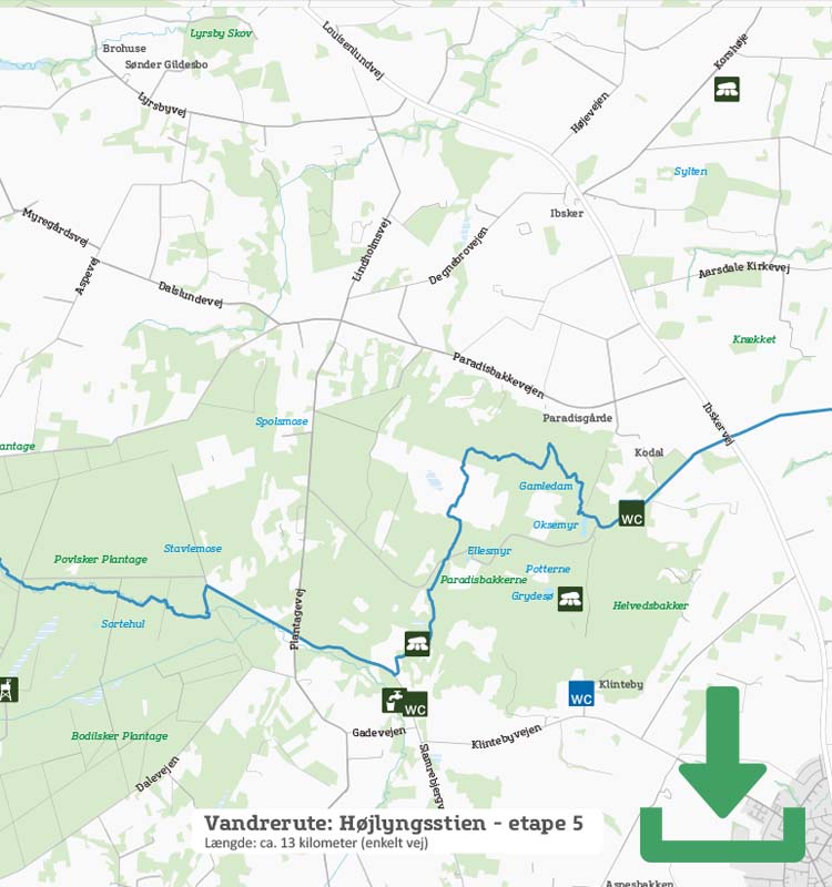
After the stretch along Øle Å, the route follows a road for a few kilometres to Paradisbakkerne (the Paradise Hills), the private woodland with the special but appropriate name, because Paradisbakkerne is both hilly and a paradise of natural scenery. Follow the signs into the forest past the remains of Gamleborg (the Old Castle) and onwards across the heather-covered plateau in the middle of the forest before heading into Bornholm’s very own Grand Canyon, Majdalen. Note the unique candelabra pine as you descend into the valley.
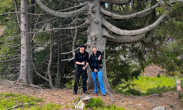
Candelabra pine


For the next few kilometres, follow the yellow route in Paradisbakkerne (the Paradise Hills) and pass through forest and over rocks, past the erratic boulders of Trommerestenene along the impressive 8-metre deep rocky Dybedal valley, and past the dammed lake bordered by rocks, Gamledam.

Once out of Paradisbakkerne, the route travels in an almost straight line down to the sea and Årsdale. Enjoy the fact that almost every 3 kilometres you have a fabulous view of the Baltic Sea, which opens in a vast expanse in front of you.

Højlyngsstiens 5 hiking stages:

Leg 1 – Sandvig to Ravnedalen

Leg 2 – Ravnedalen to Rø Plantage

Leg 3 – Rø Plantage to Rytterknægten i Almindingen

Leg 4 – Rytterknægten to Ølene

Leg 5 – Ølene to Årsdale


Places on the route:

On this hike, you get a chance to visit the following places:

1

Mikkeler Aarsdale

An old red brick building sat on the beautiful beaches of Årsdale. Under danish terms it can be no more idyllic when Mikkeller opens the doors to the old ice house, the home of the bar and restaurant.

2

Aarsdale Silderøgeri

The smokehouse’s proud traditions go back three generations to the fisherman Anton Peter Pedersen, the first owner of Aarsdale Røgeri.

3

Aarsdale Harbour

Aarsdale Harbour is an active fishing hamlet situated along the east coast of Bornholm, two nautical miles south of Svaneke.

Find more hiking paths here

Bornholm is a paradise for any nature lover. Find more hiking paths below...

Theme
Bornholm's Hiking Guide - Get tips for the best hiking trails here
Theme
Read all about hiking on Bornholm here
0
You have no favorites
You have 1 favourite
You have 0 favourites
Send us an e-mail
Write to us.

Send us an e-mail:

info@bornholm.info

Tourist information
Call us
Call us

On the phone:

(+45) 56 95 95 00