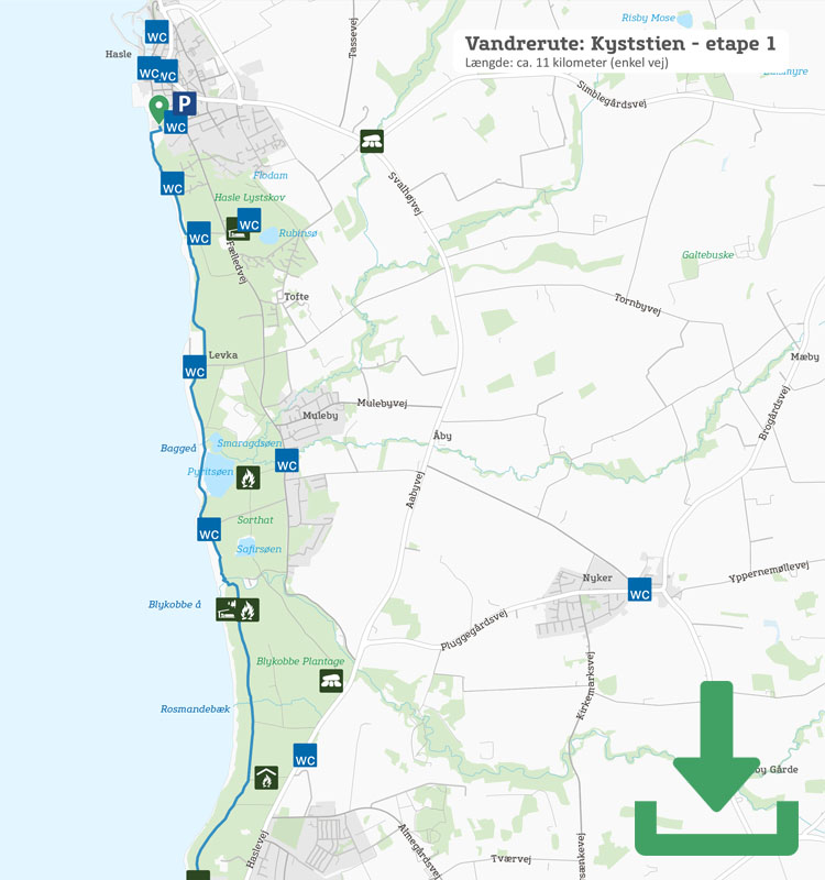
Article

Hiking route: The Coastal Path leg 1 – Rønne to Hasle

Approximately 120 kilometres of beautiful and varied hiking around the entire island: From the beaches in the south to the cliffs in the north. The walk can be done as a multi-day hike, but is also ideal for shorter legs. This is the hike for anyone who really wants to get Bornholm under their skin, and under their hiking boots.

Gitte Holtze

Hiker and outdoor freak as well as journalist, lecturer and author of "jeg lever" about Gitte's hike along the Pacific Crest Trail and "Gå langt", a guidebook to long hikes.

Trekandtell.dk

We have chosen to divide the coastal path into seven legs. This article describes leg one from Rønne to Hasle.

Facts

Duration:
3 hours
Length:
11 km
Difficulty level:
Easy to Antoinette Beach, medium to Pyritsøen, easy to Hasle
Suitable for prams and wheelchairs:
No
Parking:
If you only want to walk this leg, you can park at Bornholms Velkomstcenter (Bornholm’s Welcome Centre) in Rønne or at Hasle Røgeri (Hasle Smokehouse)
Toilets:
At the harbour in Rønne, at Antoinette Beach and in Hasle
Access to water:
At the public toilets in Rønne, at Antoinette Beach and in Hasle
Surface:
The route is relatively flat and is on asphalt (out of Rønne), then mainly forest road, some beach and nature trail
Special remarks:
With its distinctive moonscape, Kultippen is a fascinating area to study further. Both Antoinette Beach and Klympen Beach just before Hasle are ideal for swimming.


Map of the route

Below you can download a pdf with an A4 map of the route.

Route description

One of the easier stages on Kyststien, but still pleasant as you walk along the beach, in the forest and past the spectacular moonscape, the Kultippen (The Coal Tip).

From Bornholm Welcome Centre, head north along the coastal road to the roundabout, continue towards Hasle and follow the signs for Kyststien – depicted by a white man on an orange background – into the forest. The route goes towards Antoinette Beach and from there along the forest path in Blykobbe Plantage along the beach.


After a few kilometres you reach Blykobbe Å and then follow the sometimes steep coast past Sorthat-Muleby before you reach Pyritsøen (Lake Pyrit), a former clay pit that is now a beautiful lake, and a little further on, the small fishing village of Levka.

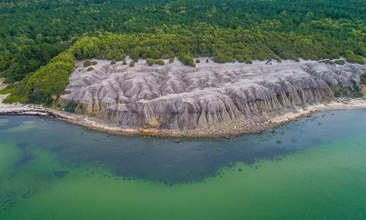
The next and very special area on the route is Kultippen (The Coal Tip), a remarkable vegetation-free area formed by deposited sulphurous clay, where the only change in the landscape is a few remnants of past history – tipping trucks from the time when the area was a coal industry.

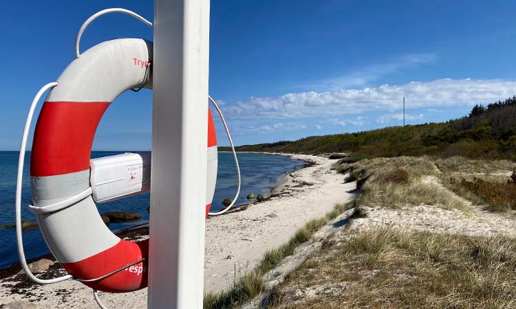
Then you follow the path right down by the lovely and often deserted beach, until the route turns up the slopes along the coast to Hasle Røgeri (Hasle Smokehouse).

The Coastal Path 7 hiking stages:

Leg 1 – Rønne – Hasle

Leg 2 – Hasle – Sandvig

Leg 3 – Sandvig – Gudhjem

Leg 4 – Gudhjem – Svaneke

Leg 5 – Svaneke – Snogebæk

Leg 6 – Snogebæk – Boderne

Leg 7 – Boderne – Rønne


Places on the route:

On this hike, you get a chance to visit the following places:

1

The Pyrite Lake in Sorthat

Come close to the near and far past by the Pyrite Lake. From 170 million years old footprints to the 18th century industry.

2

Kultippen

This site is one of the best places on Bornholm to do astrophotography.

3

Hasle Røgeri

Hasle Smokehouse is the last smokehouse on Bornholm where smoking is done in the oldfashioned traditional way with open chimneys and alderwood.

Find more hiking paths here

Bornholm is a paradise for any nature lover. Find more hiking paths below...

Theme
Bornholm's Hiking Guide - Get tips for the best hiking trails here
Theme
Read all about hiking on Bornholm here
0
You have no favorites
You have 1 favourite
You have 0 favourites
Send us an e-mail
Write to us.

Send us an e-mail:

info@bornholm.info

Tourist information
Call us
Call us

On the phone:

(+45) 56 95 95 00