Østre Sømarken and Geographic Junction
Go for a walk in Østre Sømarken and experience the Slusegård area and the geographical junction.
The area around Slusegård is a beach fringe with low dunes. It was a large burial site in the Iron Age.
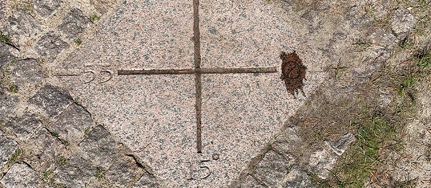
A granite rock in the dunes marks the spot where 55 northern latitude intersects 15 eastern longitude which is the centre of Danish standard time zone (Central European Time)
A well-preserved watermill is located on the banks of the steam dating from around 1800, as well as a trout house for catching anadromous (sprawing) trout.
Read more about Café Slusegarden and the Slusegården Watermill
The Slusegård area is a designated conservation area to preserve the watermill structures and to ensure acces to the general public to the mill and beach.
Ownership: Private